OpenStreetMap vs Offnadir Delta MCP
A side-by-side look at the OpenStreetMap and Offnadir Delta MCP MCP servers: transport, auth, tools, quality signals, and the config to install either one in Claude, Cursor, Windsurf or VS Code.
Verdict: choose OpenStreetMap for location services work as a local process; choose Offnadir Delta MCP for location services as a local process. You can also run both side by side in one mcpServers block.
Which MCP server should you choose?
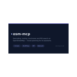 Choose OpenStreetMap when
- You need dedicated capabilities in the Location Services domain.
- You prefer a local stdio subprocess transport.
- You want tools like
geocode, reverse_geocode, route.
 Choose Offnadir Delta MCP when
- You need dedicated capabilities in the Location Services domain.
- You prefer a local stdio subprocess transport.
- Its auth model fits you: other.
- You have the keys it needs:
OFFNADIR_DELTA_API_KEY. - You want tools like
query_signals, query_stats, query_hotspots.
Feature & specification comparison
Rows where the two servers differ are marked.
| Spec | ||
|---|---|---|
| Category | Location Services | Location Services |
| Quality signal | 63/100 · Good | 64/100 · Good |
| Install command | Confirmed | Confirmed |
| Transport | Local subprocess (stdio) | Local subprocess (stdio) |
| Auth | Not declared | other |
| Pricing | Not declared | Freemium |
| Required env vars | None listed | OFFNADIR_DELTA_API_KEY |
| Verified owner | Community listing | Community listing |
| GitHub stars | 4 | 0 |
| Directory activity | 1 views 0 installs 0 upvotes | 4 views 0 installs 0 upvotes |
| Tools | 11 | 40 |
| Full listing | View OpenStreetMap | View Offnadir Delta MCP |
Tools & capabilities
OpenStreetMap tools 11
geocodeConverts a place name or address into coordinates using OpenStreetMap. Returns matching places with lat/lon, a display label and the OSM id. Provider "nominatim" (default) is best for addresses; "photon" is typo-tolerant and better for fuzzy place names.reverse_geocodeConverts coordinates into the nearest address or place name (Nominatim).routeCalculates the real-world travel distance and time between two or more places, walking, driving or cycling, on OpenStreetMap data. Waypoints are visited in the given order. Set include_steps for a turn-by-turn summary. Use route_matrix to compare many pairs, optimize_route to reorder stops.route_matrixComputes travel times and distances from every origin to every destination in one call — ideal for comparing options (e.g. 5 hotels against 3 sights). Cells are null where no route exists.optimize_routeFinds the best order to visit a set of stops (traveling-salesman optimization) and returns the optimized itinerary with total distance and time. With roundtrip (default) the tour returns to the first stop; without it the first stop is the start and the last stop the end.isochroneShows how far you can get from a place within a time or distance budget ("what is reachable in 15 minutes on foot?"). Returns a compact summary of the reachable area: bounding box and reach per compass direction. Give exactly one of minutes or kilometers.find_nearby_poisFinds points of interest near a location, sorted by distance. Category shortcuts: restaurant, cafe, bar, pub, fast_food, ice_cream, hotel, hostel, guest_house, apartment, camp_site, attraction, museum, gallery, viewpoint, information, artwork, castle, monument, ruins, supermarket, bakery, convenience, pharmacy, hospital, doctors, police, atm, bank, fuel, charging_station, parking, toilets, drinking_water, bus_stop, train_station, tram_stop, ferry_terminal, bicycle_rental, car_rental, playground, park, beach, swimming_pool. Any other OSM tag works as "key" or "key=value" (e.g. "diet:vegan=yes"). Use poi_details for the full record of one result.poi_detailsFetches the full OpenStreetMap record of one element — all tags (opening hours, website, phone, …), coordinates and a map link. Takes an OSM id as returned by find_nearby_pois or geocode, e.g. "node/240109189".suggest_meeting_pointSuggests a fair place to meet for people starting from different locations: finds venues around the geographic midpoint and picks the one with the most balanced travel times for everyone.straight_line_distanceGreat-circle ("as the crow flies") distance between two places. Instant and independent of any road network — use route for real travel distances.map_linkGenerates openstreetmap.org links to open in a browser: a marker link for a single place, or a directions link when from and to are given. Provide either "place", or both "from" and "to".
Offnadir Delta MCP tools 40
query_signalsGeolocated world events from global news media, AI-enriched with severity/GEOINT scores and collection recommendations.query_statsRoll-ups over the corpus: totals plus per-category and per-day breakdown. `total` counts the same events query_signals returns, so it matches its meta.total_count for the same query.query_hotspotsWhere activity concentrates: density grid-binned into ranked cells with peak severity, categories and representative event_ids. Events too coarse to place are counted in meta.dropped_by_plottable_count, not spread over the grid.get_world_briefAI world brief: daily (prior UTC day, all plans) or weekly/monthly by plan. freshness.is_stale: no newer day, so relay as stale.get_usageThe calling key's remaining token balance and plan capabilities. Pre-flight a metered call with it.search_imagerySearch the imagery catalog over an area and window. Metadata only, no pixels. eventDate tags each scene pre/post — **a same-day scene is same_day_unknown, never post** — and eventPoint/eventAoi add target_relation, so a scene that only clips the bbox is not read as covering the event.plan_event_imageryThe deterministic imagery plan for ONE event: checks BOTH sensors exactly once — sentinel-1-grd (SAR, the only look that survives cloud and night) and sentinel-2-l2a — against the event footprint and a pre/post window. **A VHR recommendation never invalidates what the free catalog showed.**rank_imaging_priorityWHERE, and with what class of satellite, observation is most worthwhile now: composite IMPORTANCE crossed with the SPEC CLASS the required resolution demands — coarse, hr (free Sentinel-class) or vhr. Deterministic.survey_observable_eventsWhich events a sensor can actually RESOLVE, over the FULL set. **The population is ungated by tasking readiness**, so its total sits above rank_imaging_priority and counts a different unit from query_signals clusters.predict_satellite_passesWHEN a place can next be imaged and by WHAT: 13 free-systematic and commercial-taskable families. **Every pass is a GEOMETRIC access opportunity** — no operator plan is consulted. retrieval_ok:false means timing is UNAVAILABLE, never "no passes".assess_signalAI remote-sensing deep-dive for one signal: what to observe, sensors, a collection window. Also returns a deterministic `context` whose `imagery_handoff.parameters` are the exact search_imagery inputs. Cached per signal; not-observable signals are rejected before any charge.ask_analystAsk the Delta Analyst an OSINT/GEOINT question; returns a structured brief. **Durable async**: {status:"processing", job_id} comes back immediately and the run finishes in a background worker. Fetch with get_analyst_job, or re-send the SAME idempotencyKey (no second charge).- +28 more on the listing page
Ready-to-paste client configs
Paste either block (or both) into your client config, e.g. claude_desktop_config.json or ~/.cursor/mcp.json. We only show a config when the install command is confirmed.
OpenStreetMap
{
  "mcpServers": {
    "openstreetmap": {
      "command": "npx",
      "args": [
        "-y",
        "osm-mcp"
      ]
    }
  }
}
Offnadir Delta MCP
{
  "mcpServers": {
    "off-nadir-lab-offnadir-delta-mcp": {
      "command": "npx",
      "args": [
        "-y",
        "offnadir-delta-mcp"
      ],
      "env": {
        "OFFNADIR_DELTA_API_KEY": "YOUR_OFFNADIR_DELTA_API_KEY_HERE"
      }
    }
  }
}
Frequently asked questions
OpenStreetMap is categorized under Location Services and uses a local stdio subprocess. Offnadir Delta MCP belongs to Location Services and uses a local stdio subprocess. Pick OpenStreetMap for location services work and Offnadir Delta MCP for location services.
Copy the mcpServers block from the config section on this page into your client's config (for example claude_desktop_config.json or ~/.cursor/mcp.json), then fully restart the client.
OpenStreetMap has no declared pricing — check the project's own site. Offnadir Delta MCP is listed as freemium — a free tier with paid plans. Auth: other. If a server needs environment variables such as API keys, define them under the env key in your client's MCP config.
Yes. MCP clients support multiple servers: add openstreetmap and off-nadir-lab-offnadir-delta-mcp as separate keys in the same mcpServers object, and your assistant will call tools from either one.
On AllMCPs, OpenStreetMap has a quality signal of 63/100 (Good) with 1 views, 0 installs and 4 GitHub stars. Offnadir Delta MCP has 64/100 (Good) with 4 views, 0 installs and 0 GitHub stars.