Gis MCP Server vs OpenStreetMap
A side-by-side look at the Gis MCP Server and OpenStreetMap MCP servers: transport, auth, tools, quality signals, and the config to install either one in Claude, Cursor, Windsurf or VS Code.
Verdict: choose Gis MCP Server for location services work as a local process; choose OpenStreetMap for location services as a local process. You can also run both side by side in one mcpServers block.
Which MCP server should you choose?
 Choose Gis MCP Server when
- You need dedicated capabilities in the Location Services domain.
- You prefer a local stdio subprocess transport.
- Its auth model fits you: No auth required.
- You have the keys it needs:
NOMINATIM_URL, NOMINATIM_USER_AGENT, OSRM_URL, OSRM_PROFILE, PELIAS_URL, PELIAS_API_KEY, OPEN_ELEVATION_URL, GIS_DEFAULT_CRS. - You want tools like
geocode, reverse_geocode, distance.
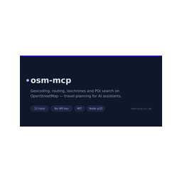 Choose OpenStreetMap when
- You need dedicated capabilities in the Location Services domain.
- You prefer a local stdio subprocess transport.
- You want tools like
geocode, reverse_geocode, route.
Feature & specification comparison
Rows where the two servers differ are marked.
| Spec | ||
|---|---|---|
| Category | Location Services | Location Services |
| Quality signal | 56/100 · Good | 57/100 · Good |
| Install command | Confirmed | Confirmed |
| Transport | Local subprocess (stdio) | Local subprocess (stdio) |
| Auth | No auth required | Not declared |
| Pricing | Free | Not declared |
| Required env vars | NOMINATIM_URLNOMINATIM_USER_AGENTOSRM_URLOSRM_PROFILEPELIAS_URLPELIAS_API_KEYOPEN_ELEVATION_URLGIS_DEFAULT_CRS | None listed |
| Verified owner | Community listing | Community listing |
| GitHub stars | 4 | 2 |
| Directory activity | 2 views 0 installs 0 upvotes | 0 views 0 installs 0 upvotes |
| Tools | 40 | 11 |
| Full listing | View Gis MCP Server | View OpenStreetMap |
Tools & capabilities
Gis MCP Server tools 40
geocodeConvert an address to geographic coordinates (latitude/longitude).reverse_geocodeConvert coordinates to an address (reverse geocoding).distanceCalculate the distance between two geographic points.bufferCreate a buffer zone around a geometry.spatial_queryPerform spatial operations between two geometries.transform_crsTransform coordinates between coordinate reference systems.centroidGet the centroid (center point) of a geometry.simplifySimplify a geometry using Douglas-Peucker algorithm.convex_hullGet the convex hull of a geometry.envelopeGet the bounding box (envelope) of a geometry.validateValidate a geometry and fix it if invalid.areaCalculate the area of a polygon geometry in multiple units.- +28 more on the listing page
OpenStreetMap tools 11
geocodePlace name/address → coordinates (Nominatim or Photon)reverse_geocodeCoordinates → nearest addressrouteDistance and duration between 2+ waypoints, `foot`/`car`/`bike`; optional turn-by-turn summaryroute_matrixTravel time/distance from every origin to every destination in one calloptimize_routeBest visiting order for a set of stops (traveling-salesman, OSRM trip)isochroneReachable area within a time or distance budget (Valhalla, or ORS with key)find_nearby_poisPOIs around a location by category or raw OSM tag, sorted by distance (Overpass)poi_detailsFull OSM record of one element: opening hours, website, phone, …suggest_meeting_pointFair meeting venue for 2–8 people (balanced travel times)straight_line_distanceGreat-circle distance, computed offlinemap_linkopenstreetmap.org marker / directions links, computed offline
Ready-to-paste client configs
Paste either block (or both) into your client config, e.g. claude_desktop_config.json or ~/.cursor/mcp.json. We only show a config when the install command is confirmed.
Gis MCP Server
{
  "mcpServers": {
    "matbel91765-gis-mcp-server": {
      "command": "uvx",
      "args": [
        "locusync-server"
      ],
      "env": {
        "NOMINATIM_URL": "YOUR_NOMINATIM_URL_HERE",
        "NOMINATIM_USER_AGENT": "YOUR_NOMINATIM_USER_AGENT_HERE",
        "OSRM_URL": "YOUR_OSRM_URL_HERE",
        "OSRM_PROFILE": "YOUR_OSRM_PROFILE_HERE",
        "PELIAS_URL": "YOUR_PELIAS_URL_HERE",
        "PELIAS_API_KEY": "YOUR_PELIAS_API_KEY_HERE",
        "OPEN_ELEVATION_URL": "YOUR_OPEN_ELEVATION_URL_HERE",
        "GIS_DEFAULT_CRS": "YOUR_GIS_DEFAULT_CRS_HERE"
      }
    }
  }
}
OpenStreetMap
{
  "mcpServers": {
    "openstreetmap": {
      "command": "npx",
      "args": [
        "-y",
        "osm-mcp"
      ]
    }
  }
}
Frequently asked questions
Gis MCP Server is categorized under Location Services and uses a local stdio subprocess. OpenStreetMap belongs to Location Services and uses a local stdio subprocess. Pick Gis MCP Server for location services work and OpenStreetMap for location services.
Copy the mcpServers block from the config section on this page into your client's config (for example claude_desktop_config.json or ~/.cursor/mcp.json), then fully restart the client.
Gis MCP Server is listed as free. Auth: no auth required. OpenStreetMap has no declared pricing — check the project's own site. If a server needs environment variables such as API keys, define them under the env key in your client's MCP config.
Yes. MCP clients support multiple servers: add matbel91765-gis-mcp-server and openstreetmap as separate keys in the same mcpServers object, and your assistant will call tools from either one.
On AllMCPs, Gis MCP Server has a quality signal of 56/100 (Good) with 2 views, 0 installs and 4 GitHub stars. OpenStreetMap has 57/100 (Good) with 0 views, 0 installs and 2 GitHub stars.